Blog
Tutorials
How to Build an Emergency Response App (2026)
Build an emergency response and tactical operations app in 2026: ICS data model, offline maps, CJIS rules, and how to ship a pilot with CatDoes in 60 days.

Nafis Amiri
Co-Founder of CatDoes

Every agency that has ever run a mutual-aid incident knows the failure mode: three teams on three different radio channels, one whiteboard, and a commander who finds out ten minutes late that a unit moved. The software that fixes this exists, but it is priced for metro departments with GIS staff, and it rarely fits a volunteer fire company, a private security team, or a county search-and-rescue unit.
Building your own used to mean a six-figure contract and nine months of waiting. That is no longer true. CatDoes generates the native responder app, the offline map, the database, and the web command dashboard from a plain-English description of how your team actually works, for less than the price of two seats of enterprise command software. This guide covers what an emergency response app has to do, how to model it around the incident command standard your people already use, which parts of compliance will stop you cold, and the one App Store rule that decides how you distribute it.
TL;DR: An emergency response and tactical operations app is a shared operating picture: live team positions on a map, incident records, assignments, timestamped logs, and comms, all working with no signal. Build the data model around FEMA ICS forms rather than screens, use React Native with offline Mapbox tiles and a realtime Postgres backend, and plan to distribute internally through MDM instead of the public App Store, because Apple's guidelines restrict location APIs for emergency services. A custom agency build runs $75,000 to $250,000 and takes 4 to 9 months. Building it yourself with CatDoes runs $100 to $200 a month and reaches a drill-ready pilot in about 60 days.
Table of Contents
What an Emergency Response and Tactical Operations App Does
Decide Which App You Are Building
Build the Data Model Around ICS Forms
The Core Feature Set
The Stack for 2026
Offline Is the Requirement, Not a Feature
Compliance: CJIS, HIPAA, and GDPR
The App Store Problem Nobody Warns You About
Build vs Buy, and What Each Costs
A 60-Day Build Plan
The Honest Limits
Start Your Build This Week
Frequently Asked Questions
What an Emergency Response and Tactical Operations App Does
An emergency response app gives everyone working an incident the same picture at the same time. It tracks where each responder is, what the incident is, who is assigned to what, and what has already happened, and it keeps that record intact when the network drops.
Strip away the vendor language and there are five jobs:
Position. Where is every unit right now, and what is its status?
Incident. What happened, where, who is running it, and what are the objectives?
Assignment. Who is doing what, under whom, on which channel?
Communication. Directed messages tied to the incident, not a group chat that scrolls away.
Record. A timestamped log that survives the incident and holds up in a review.
Anything past those five is refinement. Agencies that start with drone feeds and AI triage before they have a reliable position layer end up with a demo, not a tool.
Decide Which App You Are Building
The single most expensive mistake is trying to serve the public and your responders in one app. They are different products with different rules, different users, and different distribution paths.
Dimension | Citizen-facing (SOS, alerting) | Responder-facing (tactical ops) |
|---|---|---|
Users | Anyone, unknown devices | Vetted roster, managed devices |
Distribution | Public App Store and Google Play | MDM, TestFlight, Play private channel |
Hardest problem | Store review and false alarms | Offline reliability and identity |
Regulatory weight | Consumer privacy, accessibility | CJIS, HIPAA, records retention |
Failure cost | A missed alert | A responder nobody can locate |
Pick one and build it properly. If you need both, they share a backend and nothing else. The rest of this guide is about the responder-facing app, because that is the one nobody sells a version of that fits a team your size.
Build the Data Model Around ICS Forms

This is the part most developers skip and every agency notices. In the United States, incident management runs on the Incident Command System, and ICS is already a data schema: FEMA publishes a standard set of forms covering everything from the initial briefing to demobilization. If your tables mirror those forms, your app produces documentation your agency can actually file. If they do not, you have built a nicer whiteboard.
The NIMS ICS Forms Booklet (FEMA 502-2) defines roughly 20 forms. Six of them carry most of the operational weight:
Form | What it captures | What it becomes in your app |
|---|---|---|
ICS 201 | Incident briefing: situation, objectives, current organization, resource summary | The incident record created on dispatch |
ICS 202 | Objectives for the operational period | An objectives list attached to the incident |
ICS 204 | Assignment list by division or group | Task assignment per team, with channel |
ICS 205A | Communications list, all contact methods | Incident contact directory |
ICS 214 | Unit activity log | The auto-generated timestamped event log |
ICS 215 | Operational planning worksheet | Resource planning and staging view |
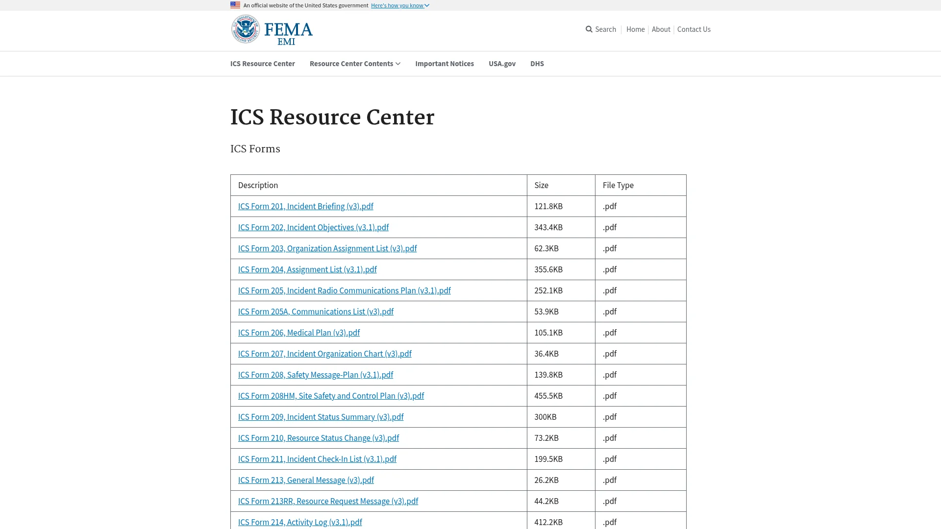
Model those six as first-class records and the rest of the app falls out of them. The ICS 214 is the highest-leverage one: every position update, assignment change, message, and photo should write to it automatically. Responders will not fill out a log during an incident, so the app has to do it for them.
This is also the step that decides whether an AI builder saves you months or wastes a week. Describe screens to CatDoes and you get screens. Describe the six forms above, field by field, and say which ones write to the activity log, and you get a Postgres schema with row-level security and the screens built on top of it. Give it the forms, not the mockups.
The Core Feature Set
Build in this order. Each stage is useful on its own, which matters because you need people running drills with it before you add the next layer. Each one is a paragraph of description in CatDoes, then a round of refinement once you have seen it on a real device in a real parking lot.
Live map with status pins. Background GPS at a configurable interval, typically 15 seconds in an active assignment and several minutes when staged, with color-coded status so a commander reads the map without tapping anything.
Incident records. Created manually, from a CAD feed, or from a dispatch text, with location, type, commander, and objectives.
Assignments and accountability. Teams assigned to divisions, with a personnel accountability report check that asks every unit to confirm status and flags whoever has not answered.
Incident-scoped messaging. Threads that belong to an incident and stay with the record. The architecture here is the same one you would use for any realtime app, and the trade-offs are covered in our guide on how to build a chat app.
Map overlays. Drawn polygons for evacuation zones, fire perimeters, search segments, and hot zones, synced to every device.
Attachments. Photos and voice notes pinned to a location and a time, which is usually the fastest way to move information a radio cannot carry.
Export. One button that produces a PDF the agency can file, generated from the ICS 214 log.
The Stack for 2026
There is no exotic technology in a tactical ops app. The difficulty is in reliability, not novelty, which is exactly why it is a good candidate for an AI build.
Layer | Choice | Why |
|---|---|---|
Build | CatDoes | Produces the React Native app, the web command dashboard, and the backend from a description, and exports the code so the agency owns it |
App | React Native with a custom dev build | One codebase for phones and tablets, with real native access to location and background tasks |
Maps | Mapbox or MapLibre via @rnmapbox/maps | Offline tile packs and custom vector overlays; not available in Expo Go, so you need a dev build |
Location | expo-location with expo-task-manager | Background position reporting that survives the app being backgrounded |
Backend | CatDoes Cloud: managed Postgres, row-level security, realtime | Position and incident state push to every device; RLS keeps agencies separated; included on every plan in a US or EU region |
Command view | Web dashboard on the same data | Dispatch works on a desktop, not a tablet |
Alerting | APNs and FCM with critical alerts | Gets through a silenced phone |
Realtime is the row people underestimate. A live position map is a realtime subscription with a map drawn on top of it, and if that layer arrives late you rebuild the app around it. CatDoes includes Postgres, authentication, file storage, and realtime subscriptions on every plan, which is why the map moves on day one instead of day forty. The backend decision is otherwise hard to reverse, so it is worth understanding before you write app code; we break the options down in our guide to choosing a mobile app backend.
Offline Is the Requirement, Not a Feature

Emergency work happens where the network is not. A canyon during a search, a basement during a structure fire, a rural county where the tower is the thing that failed. An app that needs connectivity to show a map is worse than paper, because paper does not give people false confidence.
Three rules make this work:
Pre-download tiles by jurisdiction. Offline map packs for your response area, refreshed on a schedule while devices are on station Wi-Fi, not downloaded at the scene.
Write locally first. Every action goes to a local queue with a client-generated ID and a device timestamp, then syncs. The user interface never waits on the network.
Resolve conflicts by append, not overwrite. Two commanders editing the same incident offline should produce two log entries, not a lost update. Logs append; only status fields resolve last-write-wins.
Say those three rules out loud when you describe the app, in those words. Local-first is a design decision, not a default, and an AI builder gives you what you specify. Then test it by putting a tablet in airplane mode for twenty minutes during a drill and reconnecting it. If the log comes back in the right order with nothing missing, the architecture is sound.
Compliance: CJIS, HIPAA, and GDPR
Compliance is where most self-built public safety apps quietly stall, so decide early which of these you are actually in scope for. Handling dispatch notes and responder positions is not the same as touching criminal justice information or patient records.
CJIS. If your app displays criminal justice information, the FBI CJIS Security Policy applies. Version 6.1 restructured the policy around the NIST SP 800-53 control families. Multi-factor authentication became sanctionable and auditable on October 1, 2024, SMS one-time passwords do not qualify, and every device touching CJI has to be enrolled in an MDM that supports full-device encryption and remote wipe. Encryption requirements moved too: NIST's Cryptographic Module Validation Program moved all remaining FIPS 140-2 certificates to historical status on September 21, 2026, so new deployments need FIPS 140-3 validated modules.
HIPAA. If responders record patient assessments or treatments, you are handling protected health information and every vendor in the chain needs a signed business associate agreement. The gap that shows up in audits is not the main vendor, it is the SDKs: crash reporting tools can capture app state containing PHI. Two mobile-specific rules matter most. Never put PHI in a push notification payload, and explicitly exclude local PHI from iCloud and Google Drive backups, because app data is included by default.
GDPR. For EU agencies, responder location is personal data and often falls under public-sector data residency requirements, which means the database and file storage have to sit in an EU region. Pick a backend that offers that as a deployment option rather than a promise. CatDoes Cloud runs a US region and an EU region, and you choose which one an instance lives in when you create it.
Underneath all three sits ordinary application security: least-privilege access, short-lived tokens, and audit logging on every read as well as every write. Ask for those explicitly when you describe the app. Nobody specifies audit logging on reads until they have been through an audit, and reads are what auditors ask about.
The App Store Problem Nobody Warns You About
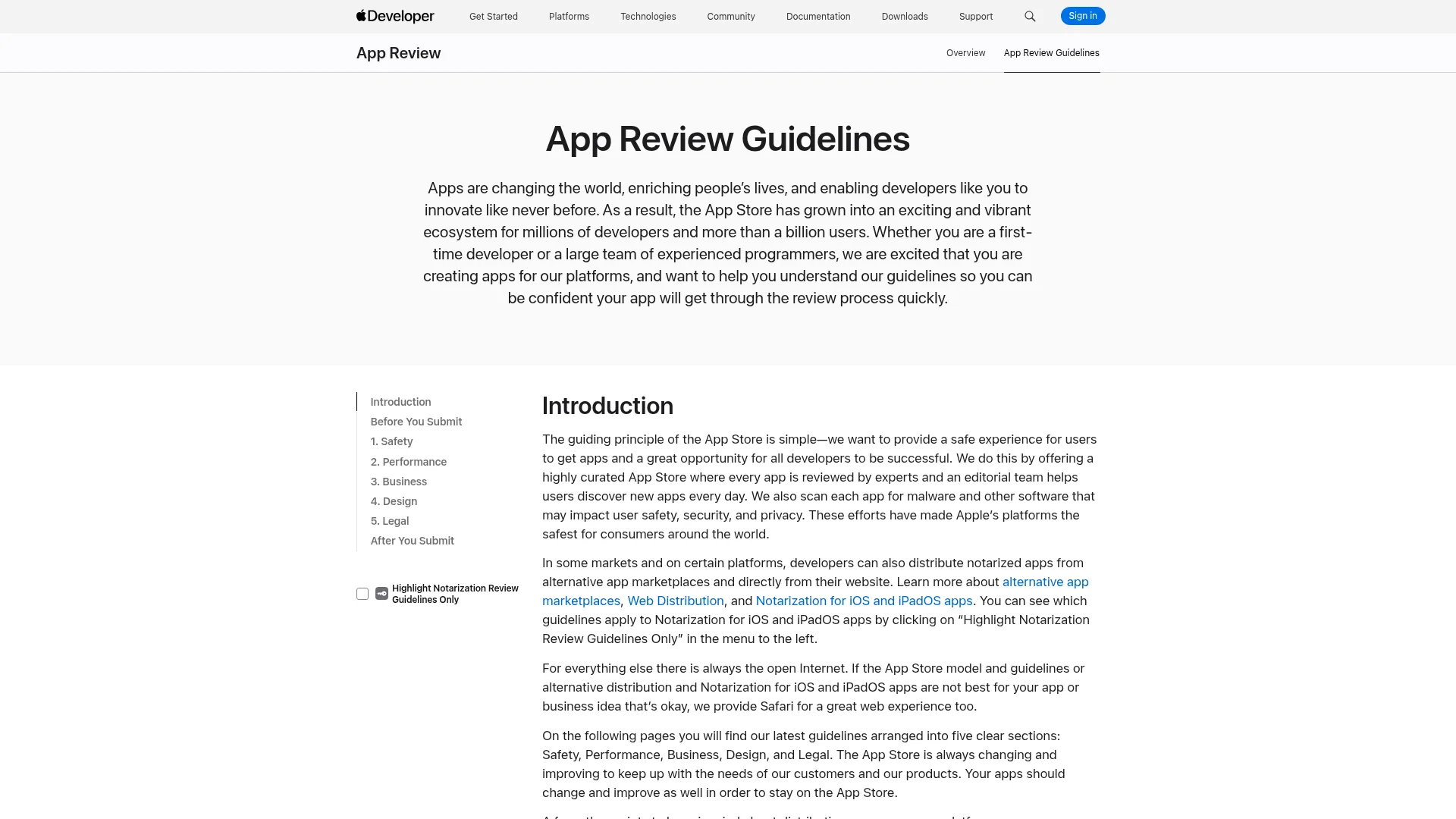
Here is the rule that changes your entire distribution plan. Apple's App Review Guidelines, section 5.1.5, state that "Location-based APIs shouldn't be used to provide emergency services or autonomous control over vehicles, aircraft, and other devices, except for small devices such as lightweight drones and toys, or remote control car alarm systems, etc."
Read that carefully. A responder-facing tactical app is a location-based app whose entire purpose is emergency services. Public App Store review is not a reliable path for it, and teams routinely discover this after they have built the whole thing. You can see the current wording on Apple's App Review Guidelines page.
The answer is that tactical apps are not consumer apps and should not be distributed like them. Your options:
Apple Business Manager with custom app distribution, which delivers privately to devices your organization owns.
Google Play private channel, restricted to your managed Google account domain.
MDM push, which you need anyway for CJIS and which makes remote wipe possible when a device goes missing.
TestFlight for pilots, capped at 10,000 testers and 90-day builds.
All of these are faster than public review, and none of them require you to explain your app to a reviewer who has never run an incident. We walk through the mechanics in our guide to internal app distribution for iOS and Android. If you do also want a FirstNet listing for a responder app, budget about four weeks for FirstNet Verified review, which includes a 99.9% availability expectation, and six to seven weeks for full FirstNet Certified.
Build vs Buy, and What Each Costs
Every vendor in this space will tell you to buy, and for one narrow case they are right: if all you need is paging and a map, buy a paging product and stop reading. But paging is not tactical operations, and the moment you need incident records, assignments, an activity log that files correctly, or a single overlay nobody else draws, buying stops working. For most volunteer, private, and county-level teams, that moment arrives in week one.
Path | Cost | Time to first real use | What you actually get |
|---|---|---|---|
Off-the-shelf alerting | Active911's published rate is $16.65 per device per year for the first 50 devices, dropping to $15.00 from 51 to 100 | Days | Paging and a map. No incident records, no ICS 214 log, no assignments, no custom overlays |
Off-the-shelf command | Quote-based; Capterra lists Tablet Command from $75 per user per month | Weeks | One standard structure-fire workflow. A 90-person volunteer roster at that rate is $81,000 a year |
Custom agency build | $75,000 to $250,000, plus 15% to 25% per year maintenance | 4 to 9 months | Exactly what you specified nine months ago, plus a change request form |
Build it with CatDoes | $100 to $200 per month, plus map and infrastructure usage | 2 to 8 weeks | Your workflow, your ICS forms, your code, changeable the same afternoon a responder complains about it |
That last row is what changed the math in 2026, and the per-seat comparison is the one to sit with. At $75 per user per month, a 90-person roster costs $81,000 a year, every year, for a workflow somebody else designed for somebody else's department. The CatDoes Pro plan is $200 a month, which is $2,400 a year, and the workflow is the one your people already run.
CatDoes builds the native React Native app and the web command dashboard from a plain-English description, with a Postgres backend, authentication, file storage, and realtime subscriptions included on every plan, in a US or EU region. On the $100 Plus plan and above you get GitHub integration and full code export, which is the part that makes this viable for an agency: you keep the codebase, you can hand it to a contractor for a security review, and you are not locked into a vendor for a system your people depend on at three in the morning.
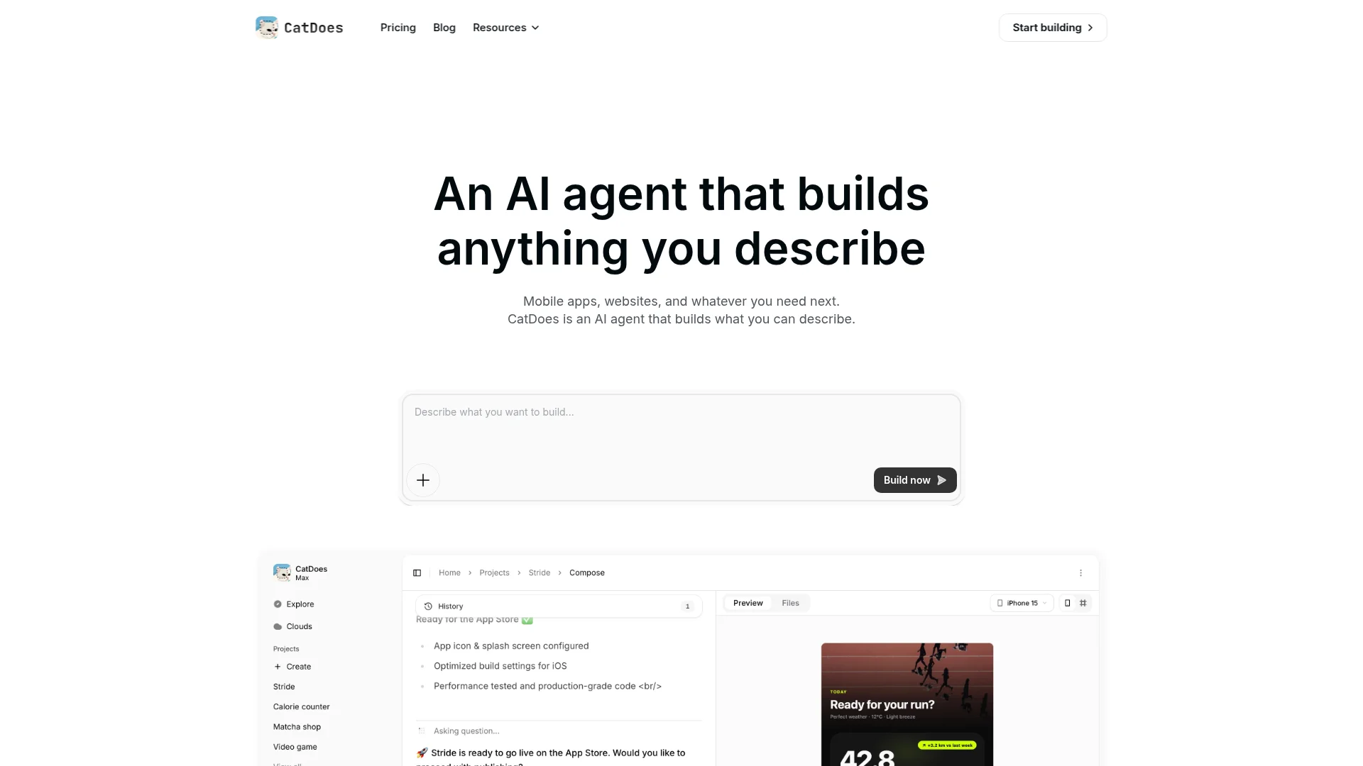
The objection worth taking seriously is not cost, it is whether a non-developer can get something responders will actually carry. The honest answer is that the coordination layer, meaning positions, incidents, assignments, logs, overlays, and offline maps, is well-trodden ground, and describing it in plain language works. The parts that still need a specialist are radio interoperability, live CAD feeds, and anything holding regulated records. Scope version one around the first list and you will have something on a drill inside a month.
Describe one incident type and how your team runs it, and see what comes back. Start building with CatDoes — the free plan runs the app and the command dashboard in a browser, so you can put it in front of your people before you pick a plan.
A 60-Day Build Plan
The goal of each phase is a drill, not a demo. Put it in front of responders early, because they will tell you within ten minutes what is wrong with the map. Each phase below is one conversation with CatDoes and then a few days of fixing whatever the drill exposed.
Days 1 to 14, position. Auth, roster, background location, live map with status pins, web command view. Run one tablet on a real drill at the end of week two.
Days 15 to 30, incidents. ICS 201 incident records, objectives, ICS 204 assignments, the automatic ICS 214 activity log, PAR checks.
Days 31 to 45, comms and terrain. Incident-scoped messaging, photo and voice attachments, drawn overlays, offline tile packs for your jurisdiction.
Days 46 to 60, hardening. Audit logging, PDF export, MFA, MDM packaging, and a tabletop exercise with the network deliberately turned off.
Do not skip the tabletop. It is the only phase that tells you whether the thing works when it matters.
The Honest Limits
Anyone selling you a build tool for life-safety software should tell you where it stops. For CatDoes specifically:
No CJIS or FedRAMP authorization. CatDoes Cloud is not a CJIS-compliant hosting environment and CatDoes does not sign business associate agreements. If your app must hold CJI or PHI, that data belongs in an environment your agency controls, with CatDoes handling the interface and the non-regulated layers.
No self-hosting. The managed backend is managed. Code export means you can move the app; it does not mean you can run the included backend on agency hardware.
No point-in-time recovery yet. There is no user-facing backup or snapshot feature in CatDoes Cloud today, so you own your backup strategy.
Realtime connections are capped by plan. The Pro plan allows 50 concurrent realtime connections per instance and Team allows 100. A 40-person department fits. A 200-responder multi-agency operation needs a Cloud add-on, which raises the ceiling to 200 on Cloud Pro and 1,000 on Cloud Scale.
Radio and CAD integration is real work. P25 interoperability and live CAD feeds are integration projects regardless of what builds your app.
None of that rules out a self-built tactical app, and none of it touches the coordination layer, which is where most of the operational value sits anyway. Scope version one around positions, incidents, assignments, logs, and maps. Keep regulated records in the system your agency has already authorized, and let the app you build be the thing everybody actually looks at during the incident.
Start Your Build This Week
Pick the single incident type your team runs most often. The structure fire, the missing-person callout, the event post assignment. Write down how it goes today: who gets notified, who shows up, who tracks it, and what gets filed afterward.
That paragraph is your prompt. Describe it to CatDoes and you will have a live map, a roster, and an incident record to argue about by the end of the week. Run it on a drill. The argument that follows is worth more than another month of planning, and it is the one thing a $75,000 statement of work cannot buy you.
Build your emergency response app with CatDoes
Frequently Asked Questions
Can I build an emergency response app without coding?
Yes, for the coordination layer. CatDoes generates the native responder app, the offline map, the database, and the web command dashboard from a plain-English description, and you refine it in plain language. Radio interoperability, CAD integration, and CJIS-scoped data still require specialist work.
What is the best app builder for an emergency response app?
For the responder-facing coordination layer, CatDoes is the strongest fit among AI app builders, because a tactical app needs three things at the same time: native React Native output for background location, realtime subscriptions for a live position map, and code export so the agency owns the system it depends on. CatDoes includes a Postgres backend with realtime on every plan, in a US or EU region, and full code export from the $100 Plus plan up. It is not a CJIS-authorized environment, so criminal justice information stays in the system your agency has already authorized.
How long does it take to build a tactical operations app?
A usable pilot with live positions, incidents, assignments, and offline maps takes roughly 60 days of part-time work with CatDoes. A traditional agency build of the same scope runs 4 to 9 months.
Will Apple approve an emergency response app?
Guideline 5.1.5 says location-based APIs should not be used to provide emergency services, which makes public App Store review unreliable for responder-facing tactical apps. Distribute internally through Apple Business Manager, a Google Play private channel, or your MDM instead.
Does the app need to work without internet?
Yes. Offline maps and local-first writes are a core requirement, not an enhancement. Pre-download tiles for your response area and queue every action locally so the interface never waits on the network.
What does it cost to build an emergency response app?
A custom agency build runs $75,000 to $250,000 plus 15% to 25% annually for maintenance. Per-seat command software runs about $75 per user per month, which is $81,000 a year for a 90-person roster. Building it yourself with CatDoes runs $100 to $200 per month plus map and infrastructure usage.
Do I need to follow ICS?
If you operate in the United States and coordinate with other agencies, yes. Modeling your data on FEMA's ICS forms means your app produces documentation that files correctly and reads correctly to any mutual-aid partner.
Is CatDoes CJIS compliant?
No. CatDoes Cloud is not a CJIS-authorized environment. Use it for the coordination layer and keep criminal justice information in a system your agency already has authorized.
Nafis Amiri
Co-Founder of CatDoes